
 United StatesJFK
 MexicoMEX
 BrazilGRU
 ArgentinaEZE
 ChileSCL
 ColombiaBOG
 PeruLIM
 PanamaPTY
 Costa RicaSJO
 Dominican RepublicPUJ
 JamaicaMBJ
 BahamasNAS
 BarbadosBGI
 United KingdomLHR
 IrelandDUB
 FranceCDG
 GermanyFRA
 NetherlandsAMS
 BelgiumBRU
 SwitzerlandZRH
 AustriaVIE
 ItalyFCO
 SpainMAD
 PortugalLIS
 GreeceATH
 TurkeyIST
 DenmarkCPH
 SwedenARN
 NorwayOSL
 FinlandHEL
 PolandWAW
 Czech RepublicPRG
 HungaryBUD
 IcelandKEF
 United Arab EmiratesDXB
 QatarDOH
 Saudi ArabiaRUH
 IsraelTLV
 EgyptCAI
 MoroccoCMN
 South AfricaJNB
 KenyaNBO
 NigeriaLOS
 IndiaDEL
 PakistanLHE
 Sri LankaCMB
 SingaporeSIN
 MalaysiaKUL
 ThailandBKK
 VietnamSGN
 PhilippinesMNL
 IndonesiaCGK
 Hong KongHKG
 ChinaPVG
 TaiwanTPE
 JapanHND
 South KoreaICN
 AustraliaSYD
 New ZealandAKL
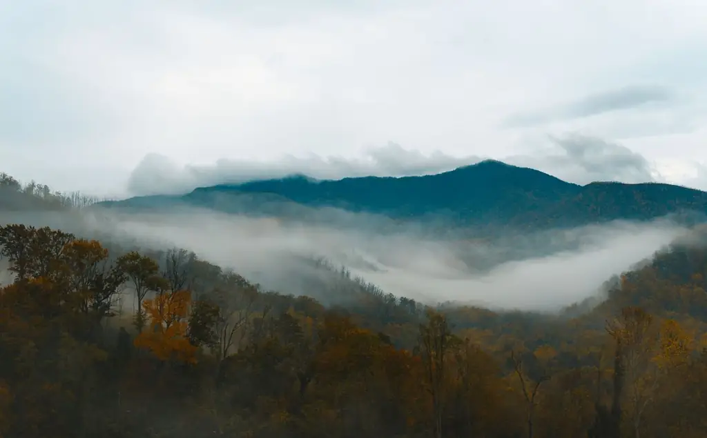
Most national parks begin at a gate and a ranger. The Great Smoky Mountains begin where the road starts to climb. A car leaves Gatlinburg, passes a visitor center and a sign, and within minutes is in the park. There is no entrance fee, but there is a parking tag, a short list of roads that matter and a calendar of seasonal closures that changes what a day can include.
A Great Smoky Mountains National Park private tour with driver is therefore a question of route more than ticketing. The chauffeur knows which side of the park suits your hotel, which road is closed this month, and where a vehicle of your size is allowed. This guide uses the National Park Service's own pages, which we read in October 2026, and marks what they leave unsaid.
How do you get to Great Smoky Mountains National Park by car?
The park has three main doors: Sugarlands near Gatlinburg in the north, Townsend on the west side and Oconaluftee near Cherokee, North Carolina, in the south. From Knoxville's airport, the north door is about 65 to 75 km (40 to 46 miles), typically one to one and a half hours.
The park is open 24 hours a day, 365 days a year, according to the Park Service, although visitor centers follow seasonal hours. Sugarlands is described as the northern gateway near Gatlinburg, and Oconaluftee as the southern gateway beside Cherokee. The park's mailing address is 107 Park Headquarters Road in Gatlinburg; it is not a navigation address, so use the visitor-center names.
The three doors compared
| Entrance | From | Distance by road | Typical drive | Best for |
|---|---|---|---|---|
| Sugarlands, near Gatlinburg | Knoxville airport (TYS) | about 65 to 75 km (40 to 46 miles) | 1 to 1.5 hours | Newfound Gap Road, Kuwohi, Roaring Fork |
| Townsend and Cades Cove | Gatlinburg via Little River Road | about 45 km (28 miles) | 1 to 1.5 hours | Cades Cove, quieter valley roads |
| Oconaluftee, near Cherokee | Asheville, North Carolina | about 85 km (53 miles) | 1 to 1.25 hours | The southern side, mountain farmstead |
| Gatlinburg | Nashville | about 350 km (220 miles) | 3.5 to 4 hours | Long-distance arrivals, with a stop in Knoxville |
The travel times above come from a map-based estimate, not from the park. Allow more on weekends and in October, when traffic through Gatlinburg and Pigeon Forge slows. Our airport hub lists the gateways we serve, and our Nashville chauffeur page is the starting point for a long run from Music City.
The parking tag, explained
The Park Service's fees page states that parking tags are required for all vehicles parking longer than 15 minutes. Three durations are sold for all vehicle sizes and types: daily at $5, weekly at $15 and annual at $40, as of 2026. A tag is valid for one vehicle and must show a plate number matching that vehicle. The Park Service stresses that the tag is not an entrance fee.
Tags are sold at visitor centers, local stores and tag machines, and daily and weekly tags can be bought through recreation.gov and printed. For a chauffeured booking, the driver arranges the tag for the vehicle you are in, so you do not need to buy anything. Pull-offs where you stop for less than 15 minutes do not need one, though the long list of overlooks and trailheads tempts most people to stay longer.
Newfound Gap Road and Kuwohi
Newfound Gap Road, US 441, is the park's central road. The Park Service lists it, with Little River Road and the Cades Cove Loop Road, as a primary road open year-round, weather permitting. It links Gatlinburg and Cherokee across the high ridge.
Kuwohi Road, formerly Clingmans Dome Road, is a seasonal spur. The 2026 schedule shows it open from April 1 to November 29, closing for snow, ice or other hazardous weather. At the end of the road, the walk to the tower on the highest peak in the park is one mile (1.6 km) round trip on a steep, paved path, according to the Park Service, which also warns of extreme crowding and limited parking and mentions a shuttle option. The trail is paved but very steep. A parking tag is needed to park for more than 15 minutes. If your visit falls in early December, the road is likely to be closed, so check the seasonal road schedule before you plan around it.
Choosing your side of the park
The north door suits visitors in Gatlinburg and Pigeon Forge. Sugarlands Visitor Center, which the Park Service places near the intersection of Newfound Gap Road and Fighting Creek Gap Road, has the backcountry office and a riding stable beside it, and nearby trails lead to streams, waterfalls and old log cabins. It is the logical first stop to collect a map and ask about conditions.

The west door at Townsend feeds Little River Road and Cades Cove, and it is usually the calmest of the three for traffic. The south door at Oconaluftee, beside Cherokee, is best for guests arriving from Asheville or from Atlanta by the southern route. Ask us at booking where you are sleeping, and we choose the door that gives the shortest approach rather than crossing the ridge twice.
Cades Cove
The Cades Cove Loop Road is an 11-mile one-way circuit around a valley, open sunrise to sunset each day. The Cades Cove page says to allow at least two to four hours, longer if you hike, and describes traffic as heavy in summer and fall and on weekends year-round. It also says the loop is closed to vehicles on Wednesdays, typically from May through September.
For a car, the practical advice is to go early on a weekday and to use paved pull-outs. A chauffeur lets the whole party look out of the windows at once. Cades Cove lies about 45 km (28 miles) from Gatlinburg by Little River Road; allow an hour to an hour and a half to reach it.
Roads where vehicle size matters
Several secondary roads have size and trailer restrictions, according to the 2026 schedule. The Roaring Fork Motor Nature Trail runs from April 17 to November 29 and is one-way and very steep, with size and trailer restrictions. Rich Mountain Road is one-way, open April 10 to November 9, with the same restrictions. Parson Branch Road is a one-way gravel road of 8 miles, open May 1 to November 9, and high-clearance vehicles are recommended. Heintooga Ridge Road is open from May 15 to October 31, also with restrictions.
That is where vehicle class counts. A Luxury SUV or a sedan is usually appropriate for the main roads. An Executive Sprinter or a mini-coach is better kept to Newfound Gap Road, Little River Road and the Cades Cove Loop, and the restricted roads should be checked against the vehicle before you commit. Straight Fork Road dates were still pending because of Hurricane Helene impacts when the Park Service updated its schedule.
Other roads remain open all year but need care. The 2026 schedule lists Wear Cove Road as narrow, with size and trailer restrictions and a 10-ton weight limit, and Cataloochee Road as gravel that closes for snow and other hazardous weather. Upper Tremont Road closes for snow, ice or muddy conditions. Treat the schedule as the final word, since weather can close a road at short notice.
What is closed right now
The Park Service's conditions page, updated in August 2026, lists a few closures that affect trip plans. Laurel Falls Trail is closed for rehabilitation, with a reopening expected in 2027. Bullhead Trail is closed Monday to Thursday, excluding federal holidays, from May 4 until November 19, 2026. The temporary closures page, updated on October 15, 2026, adds that the Carlos Campbell Overlook on Newfound Gap Road is closed while crews assess cracks in the pavement, and that Mingus Mill is temporarily closed for preservation work.
None of these closes the park, but they can change a plan built around a particular waterfall or mill. Check the conditions page again in the week before you travel.
Fall, weather and crowds
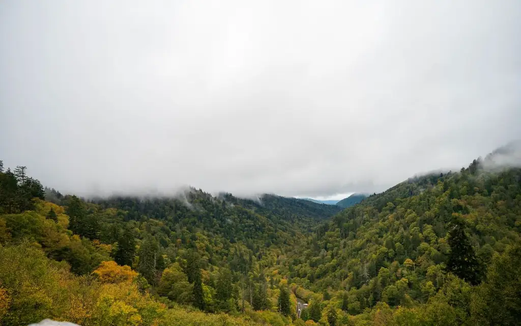
Autumn is a busy season. The official Gatlinburg tourism site lists its harvest festival and other events through November 1, including Oktoberfest at Ober Gatlinburg and a run of Halloween events. Colors move down the mountains through the season, with higher ground changing first, so a visit in late October may see peak color at lower elevations and bare trees near the top. Dress in layers, because the high elevations are noticeably colder than the valley.
Weekdays are quieter than weekends. An early start is the best protection against slow traffic on Newfound Gap Road. Wildlife, including black bears, is part of the park, and the Gatlinburg site carries bear-safety resources.
Mountain weather does not follow valley weather. A warm, clear afternoon in Gatlinburg can be cold and cloudy at the high overlooks, which is why the Park Service schedule keeps mentioning snow, ice and hazardous conditions. Carry a layer for each person, keep water and snacks in the car, and let the driver decide at the last turn whether the high road or the valley road will give the better afternoon.
A day from Gatlinburg: sample route
- Early pickup in Gatlinburg or Pigeon Forge, or from Knoxville airport after a morning flight.
- Sugarlands Visitor Center, a short stop at the northern gateway, with the parking tag handled.
- Newfound Gap Road over the ridge, with overlooks (subject to closures).
- Kuwohi, if open and not crowded, for the one-mile round trip on the paved path.
- Lunch at Cherokee or back in Gatlinburg.
- Return, or an afternoon in Cades Cove on a second day.
Visitors continuing east can add the Biltmore Estate in Asheville, about 95 km (60 miles) from Cherokee. Travelers from the south may arrive via Atlanta, where our Georgia Aquarium guide covers the other end of the trip. The attractions hub lists the rest, and our private tours with driver page explains day bookings. The North America directory covers the neighboring cities.
Short walks, steep paths and thin signal
The park's pull-outs and visitor centers are the easiest places for guests with limited mobility, while the Kuwohi path is steep even though paved. Tell us at booking if anyone needs a shorter walking plan, and we will propose a Luxury SUV or a First Class Sedan with easy step-in, subject to availability. The park has few services inside the boundary. Bring water, snacks and warm layers, and fill the day's plan with a margin in case of weather.

Phone signal can be patchy on the high roads, so agree a pickup point in advance rather than relying on messages in the mountains.
Self-drive, group tour or private driver
| Option | Time to Sugarlands from Knoxville airport | Cost note | Best for |
|---|---|---|---|
| Rental car | 1 to 1.5 hours | Fuel plus a parking tag | Self-driving travelers who know the roads |
| Guided small-group tour | Varies | Fixed by operator | Solo travelers who want a narrated day |
| Gatlinburg trolley | Within town only | Free | Short hops in Gatlinburg |
| Taxi or app-based ride | 1 to 1.5 hours | Metered or surge-priced | Short hops; less practical for loops inside the park |
| Private chauffeur | 1 to 1.5 hours | Fixed fare via the booker | Families, small groups, fall color days, airport arrivals |
If you are staying in Gatlinburg and prefer a narrated, shared tour, a guided small-group tour may suit you, and we say so. A private driver suits groups that want to set their own pace and avoid driving the winding roads.
A note on conduct in the park
Keep wildlife at a distance, use paved pull-outs rather than the road shoulder, and carry out what you bring in. No client photographs and no social posts from our chauffeurs, and we are glad to use an alias on the name board.
Frequently asked questions
Is there an entrance fee for Great Smoky Mountains National Park?
No. The Park Service says the parking tag is not an entrance fee. Tags are required to park longer than 15 minutes and cost $5 daily, $15 weekly or $40 annually as of 2026.
How far is Great Smoky Mountains National Park from Knoxville airport?
About 65 to 75 km (40 to 46 miles) to Gatlinburg and the Sugarlands entrance, typically one to one and a half hours depending on traffic.
Is Kuwohi the same as Clingmans Dome?
The road is listed as Kuwohi Road, formerly Clingmans Dome Road. The 2026 schedule shows it open from April 1 to November 29, subject to weather.
How long does Cades Cove take?
The Park Service says to allow at least two to four hours for the 11-mile one-way loop. It is closed to vehicles on Wednesdays, typically from May through September.
Can a van or Sprinter use all the roads?
No. Several secondary roads, including Roaring Fork and Rich Mountain, have size and trailer restrictions. The main roads are fine for most vehicles, but check restrictions before booking.
When is the park open?
The park is open 24 hours a day, 365 days a year. Visitor centers keep seasonal hours.
What is the best time of year to visit?
Weekdays in spring and autumn are popular. October is busy because of fall color, and traffic through Gatlinburg slows on weekends.
How far is Nashville from the Smokies?
About 350 km (220 miles), typically 3.5 to 4 hours by road.
Will the driver stop at overlooks on request?
Yes, at the paved pull-outs along the main roads. Stops under 15 minutes need no parking tag, and the driver will tell you when a pull-out is crowded so you can move on to the next one instead of circling.