 United StatesJFK
 MexicoMEX
 BrazilGRU
 ArgentinaEZE
 ChileSCL
 ColombiaBOG
 PeruLIM
 PanamaPTY
 Costa RicaSJO
 Dominican RepublicPUJ
 JamaicaMBJ
 BahamasNAS
 BarbadosBGI
 United KingdomLHR
 IrelandDUB
 FranceCDG
 GermanyFRA
 NetherlandsAMS
 BelgiumBRU
 SwitzerlandZRH
 AustriaVIE
 ItalyFCO
 SpainMAD
 PortugalLIS
 GreeceATH
 TurkeyIST
 DenmarkCPH
 SwedenARN
 NorwayOSL
 FinlandHEL
 PolandWAW
 Czech RepublicPRG
 HungaryBUD
 IcelandKEF
 United Arab EmiratesDXB
 QatarDOH
 Saudi ArabiaRUH
 IsraelTLV
 EgyptCAI
 MoroccoCMN
 South AfricaJNB
 KenyaNBO
 NigeriaLOS
 IndiaDEL
 PakistanLHE
 Sri LankaCMB
 SingaporeSIN
 MalaysiaKUL
 ThailandBKK
 VietnamSGN
 PhilippinesMNL
 IndonesiaCGK
 Hong KongHKG
 ChinaPVG
 TaiwanTPE
 JapanHND
 South KoreaICN
 AustraliaSYD
 New ZealandAKL
How do you get to Lake Tahoe by car?
Fly into Reno-Tahoe (about 95 km / 59 mi to South Lake Tahoe, 1 hr 15 min to 1 hr 45 min) or Sacramento (about 185 km / 115 mi, 2 to 2 hr 45 min) and transfer by chauffeur over US-50 or Mount Rose Highway. San Francisco is roughly 4 to 5 hours away, longer in snow.
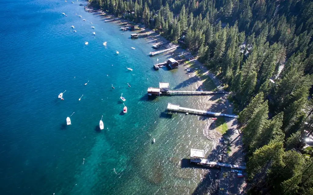
Lake Tahoe is a single body of water with two states, four distinct shorelines and a handful of mountain passes between you and it. The lake is about 35 km (22 mi) long and 19 km (12 mi) wide, sits at roughly 1,900 m (6,225 ft) and is among the deepest lakes in the United States. Nobody "arrives at Lake Tahoe". You arrive at South Lake Tahoe, Tahoe City, Incline Village or Kings Beach, and the choice decides your road, your time and your afternoon.
This guide is written for travelers who want a Lake Tahoe private tour with driver, or simply a reliable answer to how to get to Lake Tahoe by car, without spending the visit behind the wheel of a rental on a two-lane mountain road. It covers the airports, the passes, the places where cars are limited, and a realistic day around the shoreline. Every trip is booked, confirmed and invoiced by our 24/7 worldwide desk and delivered by a vetted, licensed and insured US operator.
Pick your shore before you pick your hotel
The lake splits naturally into four zones, and the drive between them is longer than the map suggests. The shoreline road is about 115 km (72 mi) all the way round. Even without stops, a full circuit is a three-hour drive in good conditions.
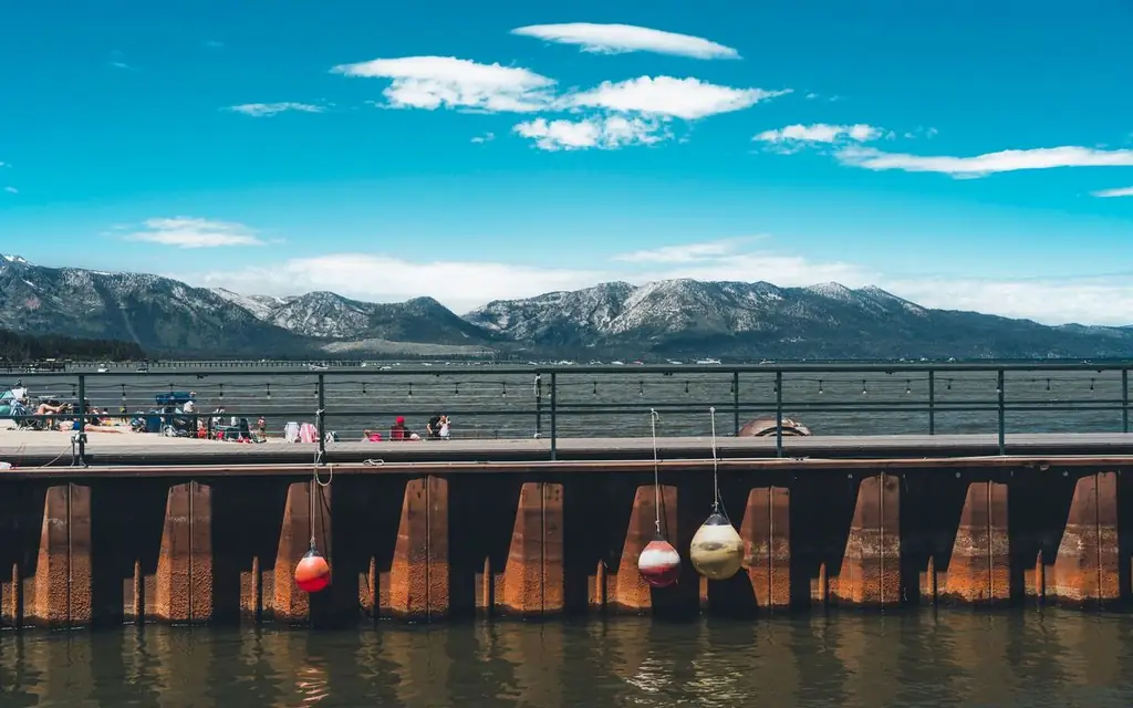
- South Shore (South Lake Tahoe and Stateline). Casinos on the Nevada line, the Heavenly gondola, most hotels and restaurants, and the closest base for Emerald Bay (about 14 km / 9 mi north on CA-89).
- West Shore. Homewood and Tahoma, quieter, with the Emerald Bay overlooks.
- North Shore (Tahoe City, Kings Beach, Incline Village). Incline Village is the Nevada-side town closest to Sand Harbor.
- East Shore. Mostly undeveloped, with a narrow highway (NV-28) and limited legal parking.
For a one-day tour, South Lake Tahoe or Tahoe City is the best starting point. The official Visit Lake Tahoe site lists lodging and activities by shore.
Reno, Sacramento or San Francisco: which airport to use
Reno-Tahoe International is the closest commercial airport, and for most visitors the right answer. From the terminal, the route south on US-395 and then either US-50 over Spooner Summit or NV-207 over Kingsbury Grade reaches the South Shore in about 95 km (59 mi). The Mount Rose Highway (NV-431) is the direct line to Incline Village: about 55 km (34 mi), 45 to 60 minutes, climbing to roughly 2,700 m (8,900 ft) before dropping to the lake. The Reno-Tahoe airport site lists current airline service.
Sacramento International works well when your flight connects there. The usual route follows US-50 east through Placerville and over Echo Summit to South Lake Tahoe, about 185 km (115 mi) and two to two and three-quarter hours; to Tahoe City you take I-80 over Donner Summit, about 190 km (118 mi) and roughly 2.5 to 3 hours.
San Francisco is the long option, about 320 to 340 km (200 to 210 mi) and four to five hours in clear conditions, but it is the right one when Tahoe is the second leg of a California trip. Our San Francisco International Airport (SFO) transfer page covers the terminal side, and the San Francisco limo service page explains how a city pickup works. Business jets serving the lake commonly use Reno-Tahoe or the Truckee Tahoe Airport; see our private aviation hub for FBO transfers.
| Airport | Distance to South Lake Tahoe | Typical drive | Best for |
|---|---|---|---|
| Reno-Tahoe (RNO) | about 95 km / 59 mi | 1 hr 15 min to 1 hr 45 min | Most visitors, both shores |
| Sacramento (SMF) | about 185 km / 115 mi | 2 hr to 2 hr 45 min | Connections via Sacramento |
| San Francisco (SFO) | about 330 km / 205 mi | 4 to 5 hr, more in snow | Combining Tahoe with a Bay Area trip |
Winter driving: chain controls, passes and a vehicle that is ready
From late autumn to spring, the roads into the basin are where a Tahoe trip succeeds or fails. I-80 over Donner Summit, US-50 over Echo Summit and the Mount Rose Highway can all see chain controls, spin-outs and temporary closures during storms. Caltrans publishes live conditions on QuickMap, and Nevada posts its own road reports.
What a chauffeur adds is judgment more than horsepower. Your driver checks the passes before leaving, may recommend leaving earlier or later than planned, and carries the traction equipment local rules require. We usually assign a Luxury SUV in winter for ground clearance and cargo space for ski bags; an Executive Sprinter makes sense for groups of up to 12 to 14. Vehicle classes are "or similar", and the exact model is confirmed at booking.
Plan flexible timing in winter. A storm can turn a 90-minute transfer into a four-hour one. Flight tracking is included, and the pickup waits 30 minutes free after a domestic landing and 60 minutes after an international one.
Emerald Bay and Vikingsholm: the stop that needs planning
Emerald Bay is the photograph most visitors have in mind: a sheltered bay with a tiny granite island, Fannette Island, in the middle. Two things make it hard for an unplanned visit. The first is parking. California State Parks lists the Vikingsholm lot as limited, open from sunrise to sunset, and likely to gate when full in peak season; its guidance is to arrive before 9 am or after 3 pm and to avoid weekends. As of 2026 the page lists vehicle day use at $10 and hourly parking at $3, with pay machines that take cash or card. Overnight parking is not allowed.
The second is vehicle size. The park page limits vehicles to 18 feet (5.5 m) or shorter. Executive Sprinters, stretch limousines and some extended-length SUVs exceed that, so for an Emerald Bay stop we assign a standard-length SUV or sedan and split a larger group across two cars if needed.
Vikingsholm itself is a Scandinavian-style house built on the shoreline in 1929. There is no road to it. The walk down from the lot is steep, about two miles (3.2 km) round trip with a climb of roughly 400 feet (120 m) on the way back, and the park asks people with mobility or medical concerns not to attempt it. Tours are run by the Sierra State Parks Foundation in summer and had ended for the season on September 30, 2026, and the page notes a restoration project, so check the Emerald Bay State Park page before you plan to go inside.
If walking down is not an option, the better plan is to stop at the roadside overlook on CA-89 above the bay, where the view is nearly the same and a chauffeur can wait in the pull-out. Fannette Island is closed to visitors in April and May for wildlife nesting; drones and dogs are not permitted at the bay.
Sand Harbor and the Nevada shore
Sand Harbor, on the Nevada side of NV-28 south of Incline Village, is the lake's best-known beach, with granite boulders and clear shallows. It is part of Lake Tahoe Nevada State Park, and the rules are strict. Nevada State Parks lists vehicle day-use reservations through ReserveNevada from May 15 to September 30, a $10 per vehicle day-use fee (more for out-of-state plates, as of 2026), and an explicit ban on stopping or dropping off along Highway 28 outside designated parking. Beach-day traffic can close the entrance when the lot fills. In other words, an unannounced drop-off at the roadside is not available, and a summer visit needs a reservation made weeks in advance.
Check the official Lake Tahoe Nevada State Park page for current rules. If Sand Harbor is not available, Memorial Point (designated parking on NV-28) and the Tahoe East Shore Trail give public lake access.
A full-day chauffeured loop around the lake
Here is a realistic day, starting from South Lake Tahoe and running anticlockwise. Distances are approximate road distances.
- 8:30 am, depart South Lake Tahoe. Drive CA-89 north along the West Shore, about 14 km (9 mi) to Emerald Bay and the overlook, about 20 minutes without traffic.
- 9:00 am, Emerald Bay. Stop at the overlook; add the walk to Vikingsholm only if you are fit and have the 2-hour margin.
- 10:45 am, continue north to Tahoe City. About 35 km (22 mi) from Emerald Bay, around 45 minutes through Homewood and Tahoma. Coffee and a lakefront walk.
- 12:30 pm, Tahoe City to Incline Village via Kings Beach. About 30 km (19 mi) along NV-28/CA-28, around 45 to 60 minutes on a summer weekend.
- 1:30 pm, lunch in Incline Village. Take the afternoon at Sand Harbor or the East Shore Trail if you have a reservation; otherwise continue the drive.
- 4:00 pm, head back south on NV-28 and US-50. About 50 km (31 mi) via Spooner Summit to Stateline, roughly an hour.
That loop is about 130 km (82 mi) of driving across eight hours. The most common error is starting after 10 am in summer, when the shoreline roads are at their busiest.
How to reach Lake Tahoe: a fair comparison
The lowest-cost way to reach Tahoe is rarely the most convenient, but it is sometimes the right one. Here is how the options compare.
| Option | Typical time from Reno airport | Cost note | Suits |
|---|---|---|---|
| Airport shuttle to South Lake Tahoe (such as the South Tahoe Airporter) | about 1 hr 30 min plus stops | Lowest | Solo travelers staying near the shuttle stops |
| Rental car | 1 to 2 hr, depends on route and weather | Metered by the day, plus parking and fuel | Confident winter drivers who want independence |
| Rideshare or taxi | 1 to 2 hr | Surge-priced and sometimes hard to find for a return | Short one-way trips in good weather |
| Private chauffeur | 1 hr 15 min to 1 hr 45 min | Fixed fare via the booker | Groups, ski gear, winter weather, tight schedules, day tours |
For one traveler going to a South Shore hotel, the airport shuttle is a perfectly good choice. A private car earns its place when you are four or more, carrying skis, traveling in snow, or treating the lake as a full-day tour rather than a destination you leave your car at.
The best time to visit
- Late June to early September. Warm days and the heaviest traffic. Wildfire smoke can affect air quality in late summer, so check the air-quality forecast before a scenic day.
- September to mid-October. Often the best balance of calm roads and clear water.
- December to March. Ski season, with Highway 89 around Emerald Bay liable to close in storms.
- April to May. Snowmelt, variable weather and the lowest crowds.
Weekday mornings are consistently better than weekends. A 7 am departure from South Lake Tahoe puts you at Emerald Bay before the lot starts to fill.
Ski days and resort transfers
Timing matters most on ski days. Resort access roads can have their own chain requirements, lots fill by mid-morning on powder days, and the return trip after the lifts close is the busiest hour of the day. Your driver drops you at the base area and meets you by text when you are ready to leave; the desk confirms the drop-off point against the resort's current rules.
Combine Tahoe with the rest of California and Nevada
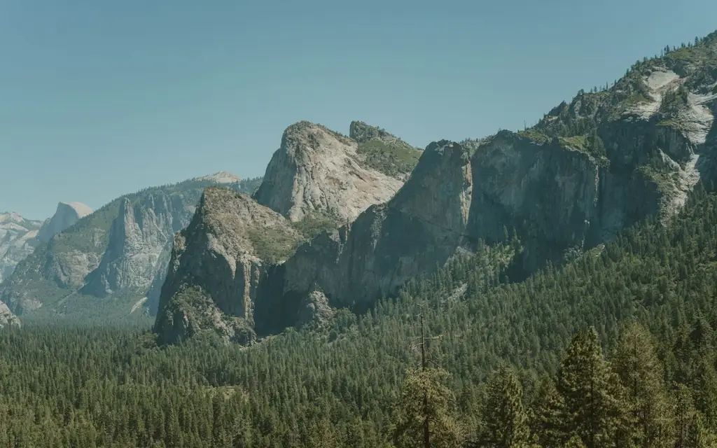
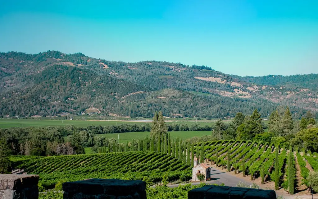
Tahoe pairs naturally with other long drives. Yosemite National Park lies to the south but the high-country route over Tioga Pass is seasonal, so most itineraries return to the Central Valley. Napa Valley and Sonoma County wine country sit on the way to San Francisco and make a natural overnight stop between the lake and the coast. For a coastal contrast, the Big Sur coast is a long day's drive to the southwest.
For a custom plan across multiple days, see our private tours with driver page and the wider North America directory. Tourist offices and visitor bureaus can book chauffeur services for their visitors with LimousineWorldwideDirectory.com through a trade account.
Frequently asked questions
How far is Lake Tahoe from Reno airport?
South Lake Tahoe is about 95 km (59 mi) from Reno-Tahoe International, usually 1 hour 15 minutes to 1 hour 45 minutes. Incline Village on the North Shore is closer, at about 55 km (34 mi) and 45 to 60 minutes via the Mount Rose Highway.
Can you do a Lake Tahoe private tour with driver in one day?
Yes. A day circuit from South Lake Tahoe or Tahoe City covers Emerald Bay, the West and North Shores and the Nevada side in about eight hours, covering roughly 130 km (82 mi). Winter or storm days are shorter and may skip parts of the loop.
How long does it take to drive around Lake Tahoe?
The shoreline road is about 115 km (72 mi) and takes roughly three hours without stops in good conditions. Summer weekends and snow can add a lot, so allow a full day if you want to stop at Emerald Bay and Sand Harbor.
Do you need reservations at Sand Harbor?
Nevada State Parks lists vehicle day-use reservations through ReserveNevada from May 15 to September 30, and the entrance can close when the lot is full. Outside that window rules change, so check the official page before you travel.
Can a limousine or Sprinter park at Emerald Bay?
The state park limits vehicles to 18 feet (5.5 m) or shorter, so stretch limousines and Executive Sprinters do not fit. For an Emerald Bay stop we assign a standard-length SUV or sedan. The lot is small and often gates when full.
Which side of Lake Tahoe is best to stay on?
South Lake Tahoe has the most restaurants and is nearest to Emerald Bay and Heavenly. Tahoe City suits the West Shore and Palisades Tahoe. Incline Village suits Sand Harbor and Nevada-side skiing. Pick the shore that matches your main activity.
What does a Lake Tahoe transfer cost?
We do not publish rates. The online booker shows the exact fixed fare for your addresses and vehicle before you confirm, and corporate or trade accounts can be set up for repeat bookings.